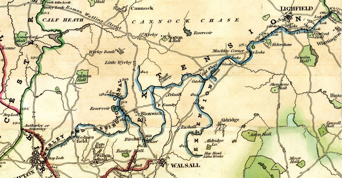
The Wyrley and Essington Canal
A brief introduction to the history of the Wyrley and Essington Canal

Key Facts
- Length - 16.5 miles
- Locks - none
Maximum boat dimensions (depending on water levels)
- Length 21.34m 70ft
- Width 2.13m 7ft
- Draught 1.22m 4ft
- Headroom 1.98m 6ft 6″
Engineers
- William Pitt
The Wyrley and Essington Canal is nicknamed the Curly Wyrley, at it was built entirely on the level, following the contours of the land. This has the advantage of allowing over sixteen miles of lock-free navigation.
An Act of Parliament passed on 30 April 1792 permitted the building of the original main line from Wyrley Bank to Wolverhampton. A further Act passed on 28 March 1794 enabled the Canal Company to extend the line from Sneyd Junction to Wyrley Bank. to Brownhills to Huddlesford on the Coventry Canal, plus the Daw End Branch to the Hay Head Limeworks and a short branch to Lord Hay’s quarries.
The canal transported coal from the mines in Cannock, Wyrley Bank, Essington and New Invention, to Wolverhampton and Walsall. It also carried limestone and other goods. Major traffic on the Wyrley and Essington was coal from the Cannock pits. Boats were gauged for toll purposes at a number of narrows formed by islands in the canal, several of which had characteristic octagonal toll offices.
Over time, the Wyrley and Essington has been badly affected by subsidence occurring in the mines it was built to serve, and continual repairs have led to some sections now running on high embankments. Water supply has also been a perennial problem.
The Canal in wartime - 1918
In November 1918, at the end of WW1, the canal fell under the jurisdiction of the Canal Control Committee's Midland Sub-Committee.
Present Day Route
- Horseley Fields, Wolverhampton (WV1 3DZ) to Brownhills (WS8 6LL)
Former Branches
The Bentley Canal formerly linked the Wyrley and Essington with the Walsall Canal via the Anson Branch. It was one of the last major branches of the BCN to be lost, being abandoned by the 1960s.
Present Day Branches (west to east)
- Short Heath Arm
- Sneyd Arm, Sneyd Junction (Oily Goughs Local Nature Reserve) and Sneyd Local Nature Reserve)
- Daw End Branch, Catshill (WS8 7EQ) to Hayhead Wood (WS9 0GG)
- Hayhead Arm (WS9 0GG)
- Anglesey Branch, Brownhills (WS8 6LL) to Chasewater Country Park (WS7 3QY)
